
check

check

check

check
check
check
check
check

check

check
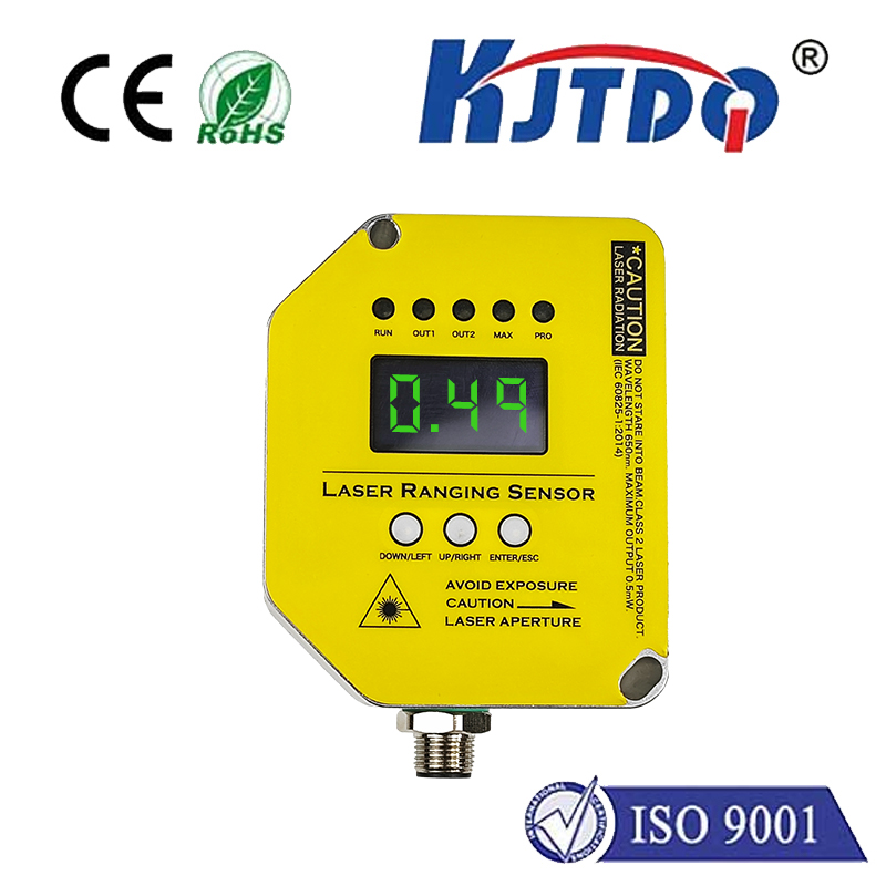
In the realm of modern measurement and sensing technology, the altitude laser rangefinder sensor stands as a pinnacle of precision and reliability. This advanced device utilizes laser pulses to calculate the distance between the sensor and a target object, specifically for determining vertical height or altitude with exceptional accuracy. Unlike traditional methods that may rely on mechanical or less precise electronic means, the laser rangefinder offers non-contact measurement, reducing errors and enhancing safety in various applications.
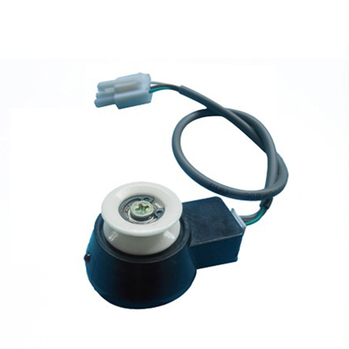
The core principle behind an altitude laser rangefinder sensor involves emitting a focused laser beam towards a target. The sensor then measures the time it takes for the beam to reflect back, using the speed of light to compute the exact distance. This time-of-flight (ToF) method ensures high-resolution readings, often within millimeters or centimeters, depending on the sensor's specifications. Key components include a laser diode for emission, a photodetector for reception, and sophisticated signal-processing circuitry to filter noise and interpret data. This technology is particularly valuable in scenarios where direct contact is impractical or hazardous, such as in aerial surveys, construction site monitoring, or environmental research.
One of the primary advantages of the altitude laser rangefinder sensor is its versatility across industries. In the aerospace sector, it is integral for drone navigation and altitude control, enabling unmanned aerial vehicles (UAVs) to maintain stable flight paths and avoid obstacles. For instance, drones equipped with these sensors can perform automated landings or terrain-following missions with minimal human intervention. In construction and civil engineering, the sensor aids in surveying land elevations, monitoring structural heights, and ensuring compliance with building codes. It allows engineers to gather data quickly from a distance, improving efficiency on job sites.
Moreover, the environmental and agricultural fields benefit significantly from this technology. Researchers use altitude laser rangefinder sensors to measure tree canopy heights, assess forest biomass, and monitor glacier changes over time. This data supports climate studies and resource management efforts. In agriculture, sensors help optimize crop spraying by adjusting nozzle height based on real-time terrain readings, reducing chemical waste and enhancing yield. The non-invasive nature of laser ranging also minimizes disturbance to natural habitats, aligning with sustainable practices.
When selecting an altitude laser rangefinder sensor, several factors come into play to ensure optimal performance. Range capability is crucial, as sensors vary from short-range models for indoor use to long-range versions for outdoor applications like mountain mapping. Accuracy and resolution determine how precise the measurements are, with high-end sensors offering sub-millimeter precision. Environmental durability is another consideration; sensors designed for outdoor use often feature rugged housings to withstand dust, moisture, and temperature fluctuations. Additionally, integration with other systems, such as GPS or inertial measurement units (IMUs), can enhance functionality for complex tasks like 3D mapping.
Despite its benefits, users should be aware of limitations. Laser rangefinders may struggle in adverse weather conditions like heavy fog or rain, which can scatter the laser beam and reduce accuracy. Reflective or absorbent surfaces might also affect readings, requiring calibration or complementary technologies. However, ongoing advancements in sensor design, including multi-wavelength lasers and improved algorithms, are addressing these challenges, making altitude laser rangefinder sensors more robust and adaptable.
In practical applications, the implementation of an altitude laser rangefinder sensor often involves careful setup and calibration. For example, in a drone-based survey, the sensor must be aligned correctly with the aircraft's axis to ensure vertical accuracy. Data output typically includes raw distance values, which can be processed through software to generate elevation models or integrated into control systems for automated responses. Many modern sensors come with user-friendly interfaces and APIs, allowing seamless connection to platforms like autonomous robots or smart infrastructure networks.
Looking ahead, the future of altitude laser rangefinder sensors is bright, driven by trends in miniaturization, cost reduction, and enhanced connectivity. As Internet of Things (IoT) devices proliferate, these sensors are becoming smaller and more energy-efficient, enabling deployment in wearable tech or smart city sensors. Innovations in artificial intelligence may further improve data analysis, enabling real-time decision-making for applications like disaster response or urban planning. With continuous research and development, the technology is poised to expand into new domains, from virtual reality to precision medicine.
In summary, the altitude laser rangefinder sensor represents a critical tool for accurate height measurement across diverse sectors. Its ability to deliver fast, non-contact readings makes it indispensable for tasks requiring precision and safety. By understanding its workings, advantages, and selection criteria, professionals can leverage this technology to boost productivity and innovation. As it evolves, the sensor will continue to shape how we interact with and measure our world, offering insights that drive progress in science, industry, and beyond.