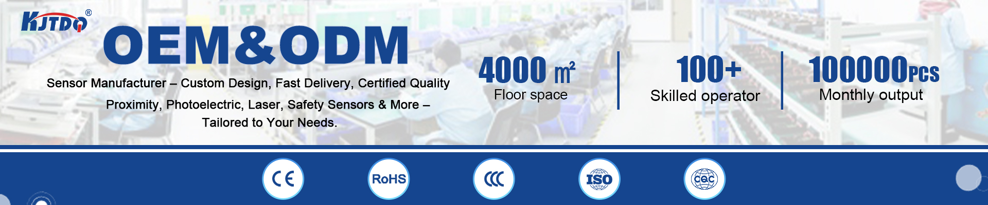
laser distance sensor 300m
- time:2025-09-13 03:26:20
- Click:0
Unlocking Precision at Scale: The Power of 300m Laser Distance Sensors
Imagine needing to measure the height of a towering construction crane, the vast expanse of a mining pit, or the precise distance across a wind farm – quickly, safely, and with unwavering accuracy. For decades, such tasks were cumbersome at best, dangerous at worst, relying on cumbersome equipment or risky manual methods. Enter the game-changer: the 300-meter laser distance sensor. This advanced tool represents a significant leap in long-range, non-contact measurement technology, enabling professionals across numerous industries to gather critical spatial data with unprecedented ease and reliability.
Why 300 Meters Matters: Bridging a Critical Gap
The 300-meter range isn’t arbitrarily chosen; it addresses a crucial operational sweet spot. It effectively bridges the gap between shorter-range handheld laser measures (typically under 200m) and significantly more expensive, complex surveying equipment designed for kilometers. This specific capability opens doors to a vast array of applications where safety, efficiency, and precision are paramount for distances previously challenging to manage easily.
Core Applications Driving Demand
The versatility of 300m laser distance sensors fuels their adoption in diverse fields:
- Construction & Civil Engineering: Rapidly measuring building heights, site dimensions, stockpile volumes, crane clearance, bridge spans, and positioning structural elements becomes significantly faster and safer. Project managers can conduct quick site surveys without complex setups.
- Mining & Quarrying: Accurately determining distances to high walls, measuring blast hole depths, calculating stockpile volumes from a safe distance, and monitoring slope stability are vital for operational efficiency and safety compliance. The 300m range often perfectly aligns with pit or quarry scales.
- Surveying & Land Management: While not replacing total stations for ultra-high precision control points, these sensors excel at rapid reconnaissance, boundary verification, topographic feature capture, and providing quick distance references over challenging terrain, supplementing more detailed surveys.
- Renewable Energy (Wind/Solar): Measuring the height of wind turbine towers (from ground or nacelle), assessing blade clearance, planning large-scale solar farm layouts, and checking distances for maintenance access are key tasks perfectly suited for this technology.
- Industrial Automation & Logistics: In specific controlled environments, 300m sensors can monitor large storage areas, guide automated guided vehicles (AGVs) in vast warehouses or ports, or provide positioning data over long conveyors.
- Forestry & Agriculture: Estimating tree heights in dense stands or measuring large field boundaries for irrigation planning benefit greatly from reliable long-range measurement capability.
Technology Behind the Measurement: How it Works (Briefly)
These sensors primarily utilize pulsed laser time-of-flight (ToF) technology. Here’s a simplified breakdown:
- The sensor emits a short, focused pulse of laser light.
- This pulse travels to the target surface.
- The pulse reflects off the target and travels back to the sensor.
- A highly sensitive receiver detects the returning pulse.
- An internal processor calculates the distance based on the precise time difference between sending and receiving the pulse, using the constant speed of light (Distance = (Speed of Light x Time of Flight) / 2).
This method is inherently robust for long distances. Key advantages include speed (distances measured in milliseconds) and the ability to measure to most solid surfaces without reflectors, although performance can vary based on surface reflectivity and atmospheric conditions.
Essential Features of a Reliable 300m Laser Distance Sensor
When selecting a sensor for demanding 300m applications, look beyond just the range specification:
- Accuracy & Precision: The fundamental reason for choosing laser technology. Look for models specifying accuracy within millimeters (e.g., ±1.0 mm or ±1.5 mm are common at shorter ranges, though accuracy tolerance often increases slightly at the maximum range - look for specs like ±1.5 mm for 0-100m, ±3 mm at 300m).
- Robustness & Environmental Protection: These tools are often used outdoors in harsh conditions. High IP Ratings (e.g., IP65, IP67) are crucial, indicating resistance to dust and water ingress. Rugged housing protects against impacts and drops.
- Measurement Speed & Stability: Rapid data acquisition is key for efficiency. Look for fast measurement rates (e.g., multiple measurements per second) and stable readings even under slight movement.
- Beam Visibility & Quality: A visible red laser beam (Class 2) is extremely helpful for aiming at distant targets. A well-collimated, narrow beam ensures you’re measuring precisely the intended point.
- Data Output & Connectivity: Seamless integration is vital. Standard interfaces like Bluetooth, USB, RS232, or even onboard WiFi allow real-time data transfer to tablets, controllers, survey software, or data loggers.
- Power Options: Long battery life or the option for external power sources is important for extended field use. Consider power consumption specifications.
- Software & Functionality: Companion mobile apps or PC software often unlock advanced features like area/volume calculation, continuous measurement, stakeout functions, and point-to-point tracking, significantly boosting utility.
Implementing with Confidence: Considerations
- Target Surface: While versatile, performance can degrade on low-reflectivity surfaces (dark, matte, or absorbent materials) or with challenging angles. Using a retroreflective target significantly boosts range and reliability at the sensor’s maximum capability. Always check the manufacturer’s specifications regarding minimum reflectance requirements.
- Environmental Factors: Intense sunlight (especially direct on the target) can overwhelm the sensor’s receiver. Heavy rain, fog, or dust can scatter or absorb the laser beam, reducing effective range and accuracy. Understanding these limitations helps plan measurement tasks effectively.
- Safety: Always use laser products responsibly. Never point the laser beam towards people, moving vehicles, or aircraft. Ensure the device complies with relevant laser safety standards (Class 1M or Class 2 are typical for these tools).
The Future is Clear: Driving Efficiency Forward
The 300-meter laser distance sensor has evolved from a niche tool into an indispensable asset. By delivering fast, accurate, and safe long-distance measurement, it directly contributes to reducing project timelines, lowering operational risks, enhancing safety protocols, and improving overall decision-making with reliable data. Whether you’re scaling heights on a construction site, managing vast mining operations, surveying land, or optimizing logistics, this technology empowers professionals to measure more, measure better, and measure faster than ever before, proving that successfully bridging significant distances with precision is no longer a formidable challenge.